FALCON'S ODYSSEY

Van Living Forum

Help Support Van Living Forum:

This site may earn a commission from merchant affiliate links, including eBay, Amazon, and others.

FALCON

Well-known member
Joined
Mar 28, 2015
Messages
500
Reaction score
0
Build thread is here...


Hello folks. This is the start of my full-time overland adventuring.

I've built up a camper van. I've sold my house. I have two days left in my last week of work.

I'll be sharing a lot of pictures and probably some rambling text here.

I've been out in Colorado for a few weeks, and soon I'll be heading north and west with the intention of arriving in Seattle in early-mid August and spending a couple weeks with friends there. I'll then go down to Portland and do the same. After that, life is full of possibilities :)

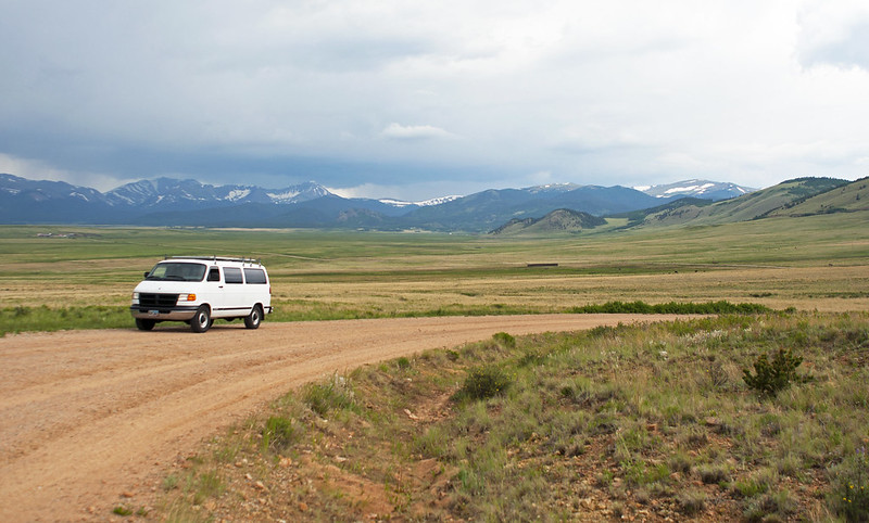
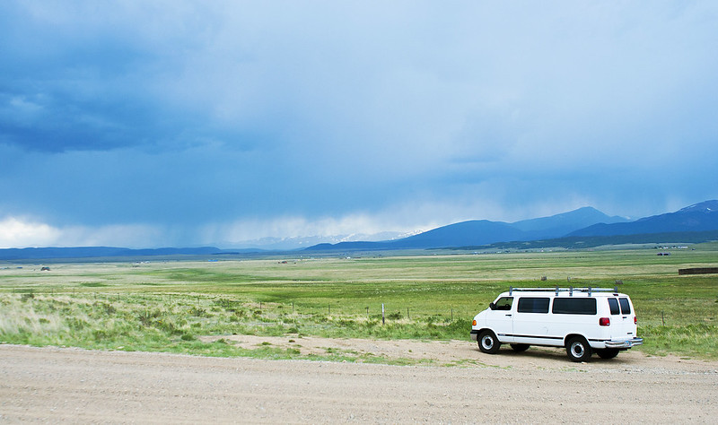
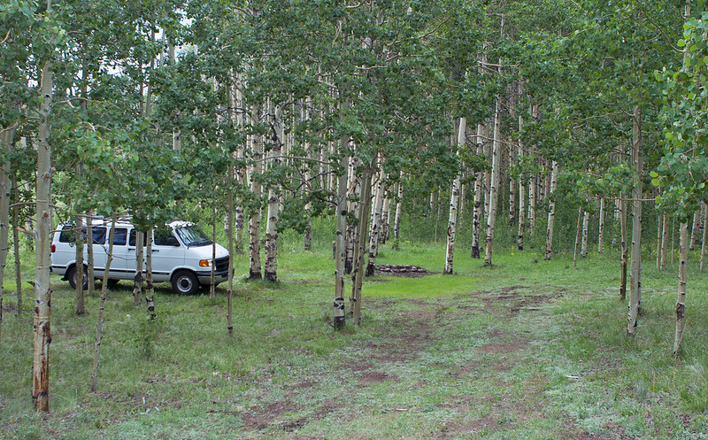
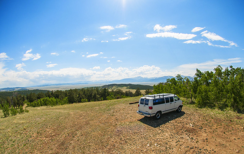
Here are some pictures from my first CO camping trip of 2016. I went out near Jefferson.

27676923584_f7cf2f88b3_c.jpg


28011530200_d98ed16023_c.jpg


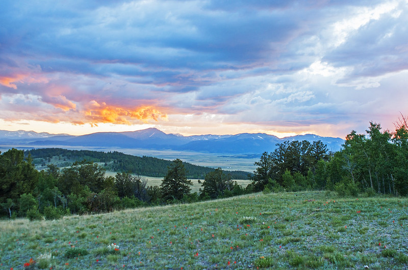
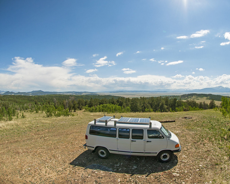
I camped here the first night. The next day I hiked around the area and found better campsites.
28214458791_fc7856e9f7_c.jpg


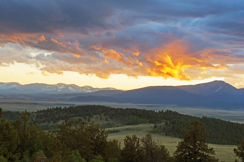
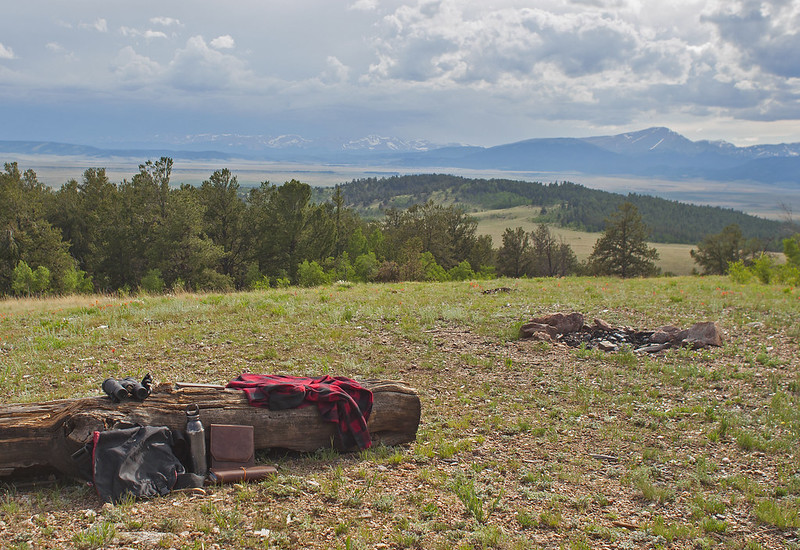
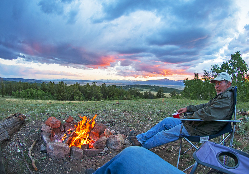
This was the site of choice. I like open spaces and big views.
28011525390_4366cf78c2_c.jpg


27676922174_fd7a47bb3f_c.jpg


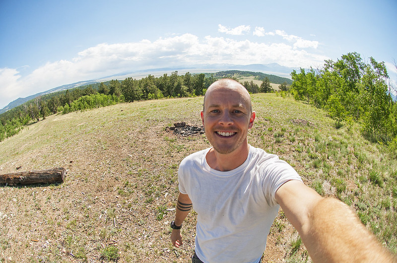
This is a guy deciding to quit his 'perfectly good' job.
27676920534_3019b67b11_c.jpg


I spent an afternoon sitting on this log, just reading and looking
28011522460_9c3546a91b_c.jpg


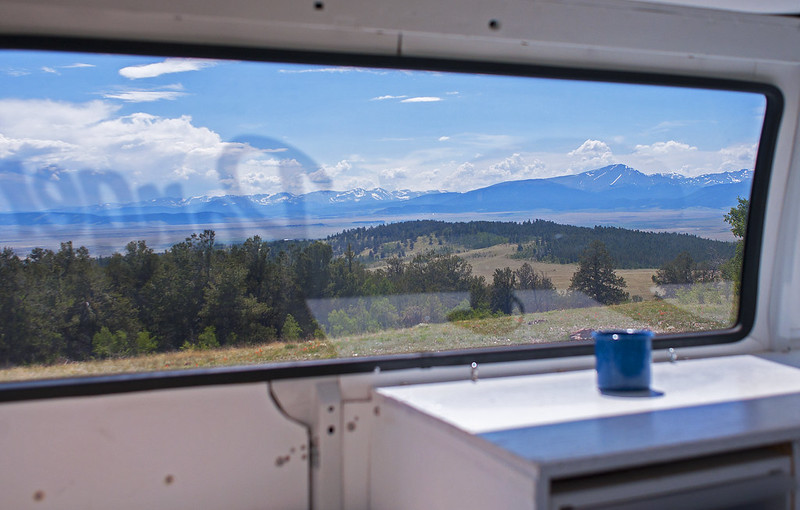
View from my table/desk inside the van
28011527350_94f03205fa_c.jpg


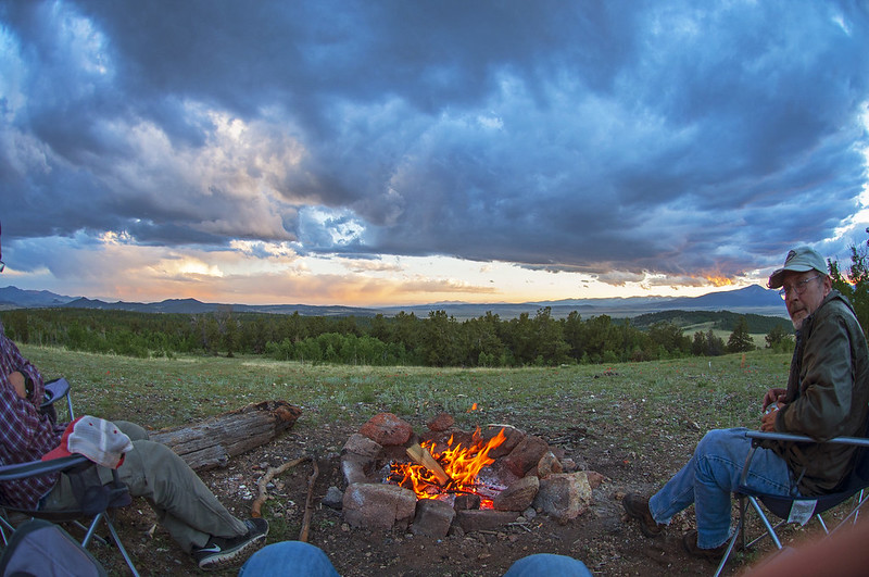
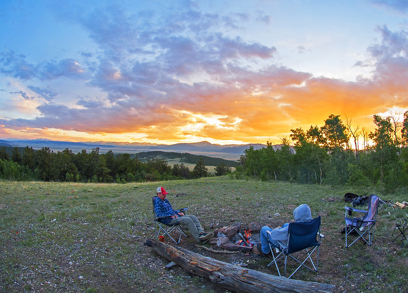
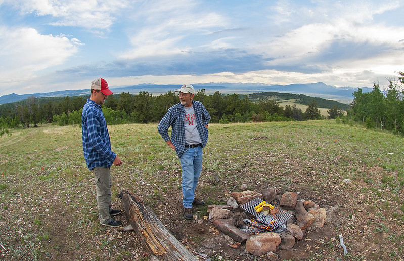
After a couple days up there, my brother and dad came out for the weekend
27676914924_3c5ac7406e_c.jpg


28011500760_69a9086527_c.jpg
 
continued...


28293005365_9835f8a3ba_c.jpg


28011503530_22fae717c7_c.jpg


28293006755_4d9f93fdcd_c.jpg


27676911054_97a901053e_c.jpg


27676913264_5458258290_c.jpg


We went to Jefferson lake one morning and my dad fished.
27676909894_6993e94c55_c.jpg


28011507240_f77161dda4_c.jpg
 
I'm planning to travel from Denver to Seattle, starting this weekend and taking about 25 days to get there. I'll post my current draft of a route below, and if you have advice on different routes to take or where to camp, I'd appreciate it. I've never been up in these areas (other than inside the cities of Seattle and Portland a bit), so I've made up this route without knowing the areas and without doing much/any research yet.


first part
https://www.google.com/maps/dir/Den...0.508053!2d43.8416798!1m0!1m0!1m0!1m0!1m0!3e0

Second part:
https://www.google.com/maps/dir/48....66944d59a!2m2!1d-122.3320708!2d47.6062095!3e0

(Some of the destinations are areas I may want to camp and some are just in there to get the route on the roads I want)
 
Looks like a blast!


Sent from my iPad using Tapatalk
 

Attachments

  • Wyoming-backroad.JPG
    Wyoming-backroad.JPG
    73.4 KB · Views: 46
Thanks for the suggestion. I'm using that route as my plan for now.

Yeah, I looked up the scenic byways and saw that there were so many of them. I was thinking it would be good to go up through Grand Teton and Yellowstone south to north, and I don't really want to back-track on this trip. I am planing to spend the entire summer next year up in these areas and I'll have a lot more time then to see all the best places

Would it be better to go up this way, in order to go on Beartooth? https://www.google.com/maps/dir/Den...02010!2m2!1d-111.1041092!2d44.6621493!1m0!3e0
 
NOOOO. That second route is almost all high plains--nothing to see there. No, go up 89 and down the Beartooth, then up to the freeway and across. The problem with Yellowstone is the drives into the Park are prettier than the park, except for the geo-thermal features. The Park itself is not very pretty.  There are three fantastic drives into Yellowstone:

1) Beartooth is the best from Red Lodge, Montana and easier to drive down going north.
2) Chief Joseph Scenic Byway from the road just North of Cody, Wyoming
3) Buffalo Bill Scenic byway from Cody Wyoming.

I'd strongly consider driving north on 89 to enter the park. If I were never going to be there again, after you see all of the park you want to see, through the Tetons and Yellowstone, EXIT down the Buffalo Bill Scenic Byway to Cody, spending a few days in Cody, then driving up again by the Chief Joseph. But you never have to re-enter the park that way, you can turn north (right) and drive out on the Beartooth, and north to the freeway and continuing east. 

I'd consider seeing the Custer last Stand Monument on the way--it can be very moving to stand right there where so many died. 
Bob
 

Attachments

  • Yellowstone-drive-001.JPG
    Yellowstone-drive-001.JPG
    115.7 KB · Views: 28
Send me a PM when you swing by Grand Teton; I'm currently working in Colter Bay Village.
 
Falcon, awesome pictures. I'll be at North Fork campground above Meeker, CO this weekend visiting a friend. If you swing through that way I'd love to meet you. Ram 2500 with red cargo trailer conversion. Person I'm visiting is the campground host and has been on the road several years - could be a wealth of information.
 

-------------------------------------------------------------------
July 8-10 – Colorado – Yankee Doodle Lake
-------------------------------------------------------------------


I had the week of July 4th off work. My last week of work would be the following week. I helped my brother move on July 2 or 3, and then was hanging out around Denver. I was enjoying it and was thinking I’d stay in Denver the entire week. But it got hot on Thursday and I checked the forecast for the weekend: even hotter. So I got my stuff ready and asked my brother for a location recommendation west of Boulder.

He said to go check out the Jenny Lake area (which is about 10 miles west of Nederland). So I did. There are two main lakes up there (Yankee Doodle, and Jenny) plus various smaller lakes. It’s nine miles of forest service road to get there. The road was a pain in the ass – tons and tons of medium-sized rocks. It took me 2.5 hours to drive those 9 miles.

Once I got to the lake, it was wonderful. I got up there Friday afternoon. There weren’t many campsites on the way up to the lake. There is a handful right by the lake though. Only one of them was occupied with someone set up to camp. I got a very good spot where someone had leveled out the ground to make a parking spot. The lake is surrounded on most sides by a steep hill, so some of the camp sites don’t have good flat spots for tents or parking.

The road was covered with a big snowdrift right after Yankee Doodle Lake. Jenny Lake is about a mile down the road. Over the weekend, some people got through the drift and smashed it down a lot. Now that it’s a few weeks later, I’m sure it’s pretty easy to get through.

There is a big ridgeline up above the two lakes. This is either the continental divide, or is close to it. At the top of the ridge you can see a LONG ways in all directions. It’s up at 11,500 feet and looking east, you can see over/past all the hills in some spots and see Boulder (or some city that way) and beyond. I don’t think there are any official hiking trails around this lake, but hiking was very easy because there were many tree clearings that you could see up to the ridges easily. I hiked a bit the afternoon I arrived and decided I wanted to hike along the big ridge. The next day I did so.

This is a really interesting area. Clearly someone had worked really hard a really long time ago to make this pass. The road continues up past the lakes and over the ridgeline. It appears they had originally tried to tunnel straight through right from Yankee Doodle Lake, but they only made it about 30 feet into the hill and gave up on that. They continued the road upwards and make a very short tunnel up near the top of the ridge. While driving back down the FS road, I spoke to an old guy that was mountain biking and he told me all about the pass. It was a railroad that was built over a hundred years ago. He told me about a location on the other side of the ridge where a helper locomotive flew off the tracks and down a big drop off (The engineer had noticed it’s brakes failed right at the top of the descent so he jumped out and let it go on it’s own)

Anyways – the hiking here was amazing. This was definitely the most scenic hiking I’ve ever done. When I first looked up at the ridgeline the first afternoon, I wasn’t sure if I’d be able to make it up there. It turned out to be quite easy. (I didn’t follow the road, I went up an older path/road (what had been a wagon trail) that was a shorter and much steeper route up to where the tunnel is.

Also, the lake made for a VERY refreshing swim.

I could only stay until Sunday because I had to get back to Denver to fly out Monday for my last week of work. Because of the FS road condition, I’ll only drive back up there if I’m planning to stay at least a full week.


PICTURES

This is the road going west from the highway. It follows the current railroad until that railroad enters a really long tunnel. (That rail line replaced the original line that was built passing up by the lakes I visited).

28410410276_0fb1fa97e2_b.jpg


On the way up the Forest Service road.
28337783822_d5ab417c13_b.jpg


27826102124_792486678b_b.jpg


The camping spot I used:
28441687925_39991a31c9_b.jpg


28363225571_d8948a48e0_b.jpg


28441726955_9058855ba3_b.jpg


This is Yankee Doodle Lake (the one I camped next to)
28409458096_3d47ee6714_b.jpg


28441937915_7862bd34ce_b.jpg


28442586685_5c343a4059_b.jpg


28409344026_e9cb426057_b.jpg
 
... continued...


This tunnel is up above the lakes. I thought it a little strange to make the tunnel so close to the top of the hill. I guess that must have been easier than blasting the rock entirely out of the way
28409726346_9e02bb178a_b.jpg


Up at the top of the ridge
28409369226_1cee7571f2_b.jpg


Having lunch at the top
27825868333_286cd4cdb0_b.jpg


27825860733_81a58a8e18_b.jpg


Looking the other way
28409344026_e9cb426057_b.jpg


Can someone explain these? They were up at/near key spots (places with views, and there was a huge one above the tunnel). Who made them? When? What are/were they used for?
27825609484_c9703c53e7_b.jpg


This was along the old wagon road the went up to the tunnel. I walked up along the ridge on the right third of the picture.
28336991772_858e698cd1_b.jpg


28441925425_d548682511_b.jpg


I wonder how much snow piles up here in the winter?
27825277204_82eb42075e_b.jpg


Driving back down. This is representative of the road
27825634053_a0afa93497_b.jpg
 

-----------------------------------------------
July 16 – The Last First Day
-----------------------------------------------


I bought and started making my van into an Adventure Mobile in April 2015. Since finishing the van around March this year, I’ve had a number of what felt like “First Days”. The first was moving into the van. I did that on March 25. Then I sold my house and drove the van out of St Louis for good – that felt like a big first day. Then I finished up some work in Iowa and could drive the van west to Colorado. Then I had my first camping trips (of this year) in Colorado. Then I had the van in and around Denver for 3-4 weeks – what felt like a transitional period.

But on this day, I had finished my last week of work. I had made my preparations to embark – to leave Denver and head towards the northwest. This time, there would be no more going back to work. There would be no more ‘launch days’. This was it – this was the Last First Day.

I drove north from my brother’s house in Loveland and then west on Poudre Canyon rd. I went up to camp near Old Roach, in what I believe is part of Roosevelt National Forest.

I loved the drive up 103 (from 14/Poudre Canyon rd, to Hohnholz lakes). It had a lot of open spaces, ranch land, etc. I prefer that over dense trees that you can’t see beyond. The Hohnholz lakes are pretty nice. I wanted to jump in for a swim, but the first lake I stopped at (#2) it was cloudy and felt too cold, and the next (#3) had an extremely muddy and silty bottom and I just didn’t feel like swimming then. So I carried on into the National Forest and found a camping spot.


PICTURES

Along 103
28409344486_d763d59012_b.jpg


On Hohnholz lakes road
28336818252_a3533e7288_b.jpg


27825270674_89b8263343_b.jpg


27825250784_39ba6249fa_b.jpg


There was a mostly smoldering fire west of this part of Roosevelt NF. The next day I drove through the smoke and saw some area that burned very recently.
28441731385_f3587a8bc2_b.jpg


Campsite for the night
27825661523_03798cc5ff_b.jpg


When I laid down to go to sleep and turned the lights off, I noticed some lightening off in the distance. This group of clouds was lighting up a bit more often than once per second. It didn’t photograph well because it was just within the clouds and you couldn’t see any bolts, and because there was a full moon.
27825643333_b0ac28b722_b.jpg


SAND DUNES

The next morning I drove west out of the NF land and went south a bit to the sand dunes. I was surprised by how sandy they actually are. It is fine, soft, and deep sand. I almost got the van stuck a couple of times.

28336661182_f9afac08cf_b.jpg


27825085224_c686130508_b.jpg


27825494893_3dcd67b877_b.jpg


Up next, Wyoming….
 
very nice, great pics. the rock formation is a foundation. if there is no wood from a collapsed cabin it was for a tent. these a very common throughout the west. they were built for a more permanent camp and not just if they were going to be used for a week or less, perhaps they had something to do with the railroad. perhaps they were built by miners/prospectors. I have used these before as camps. highdesertranger
 
Wow amazing pictures!!!! Looks like you're on a great adventure, keep sharing.

This girl is also getting ready to quit a perfectly good job to hit the road and travel, it's great to see I'm not the only crazy one. LOL
 
GREAT PICTURES !!! Looks like someone is having a great adventure. Well done :)
 
Gorgeous photos! Is that van 4 WD?


Sent from my iPad using Tapatalk
 
Top