FALCON'S ODYSSEY

Van Living Forum

Help Support Van Living Forum:

This site may earn a commission from merchant affiliate links, including eBay, Amazon, and others.
----------------------------------------------------------------------------------------------------
DRIVING - Southern and Western Wyoming.
---------------------------------------------------------------------------------------------------


MEDICINE BOW NF

After the sand dunes, I drove up into Wyoming and camped in Medicine Bow NF. I didn’t have or want to spend a lot of time looking for a good campsite since I’d only be spending the night there and taking off in the morning.


28194199790_65009efb3e_b.jpg


28372272292_9a3fe95b1b_b.jpg


28372199632_6b6b1fd3e4_b.jpg


DRIVING

I’m on a fairly short timeline to get to Seattle, so I drove straight through a big chunk of Wyoming. I drove from my camping site in Medicine Bow straight up to La Barge, WY.

28399515141_8affab5d4c_b.jpg


On the way, I came upon a HUGE lake/reservoir. It appears the Green River is dammed there. I saw a little area with a turnout and a small beach, so I pulled off.

I found one of the coolest history info signs I’ve seen so far:

28478033095_616aca8eac_b.jpg


And then I went for a swim!
28445373486_b7b89376f3_b.jpg


Once I made it up to La Barge, I took some back roads up to Alpine. I went along La Barge Rd. (315), which becomes a number of other roads. Most of this road went along a nice little river.

28372596522_c687186a2f_b.jpg


27861106574_c62f474bc4_b.jpg


27861849563_1bff15753d_b.jpg


28477649435_2836182ba2_b.jpg
 
.... continued...


28477649435_2836182ba2_b.jpg


27861060274_50936da628_b.jpg


27861807773_13fc83bcb9_b.jpg


Something I didn’t know until I happened upon signs - there is national forest land along this route. On google maps, there is no green area so I thought it was all private land. But it’s actually a part of some National Forest. The NF border is about 40 miles from La Barge. I stopped to camp right after hitting the NF. I think I lost my campsite pictures.

The next morning, I drove the rest of the way to Alpine and then Jackson. I guess a bunch of emigrants traveled along this route.  It’s about 90 miles from La Barge to Alpine, along a road that I didn’t traverse very quickly.

28372509972_946fdbcb5d_b.jpg


27861022614_ff54f0ca86_b.jpg


28372478412_51d3a63b36_b.jpg


27861762923_ed8ce29101_b.jpg


28399076581_b7cf5f5739_b.jpg


Here are some seriously amateur videos. The first two are dash cam views while driving. I’ve been having trouble recording video with my GoPro - I end up with gaps where it didn’t record. At first I thought this was from the GoPro getting too hot (which it definitely does at times), but it also happens when it’s not very hot. So then I figured the micro SD card I’m using can’t support a fast enough writing speed. So I recorded in 720p and I think that video may still have gaps. I need to look into it further. So these driving videos below are from using time lapse pictures (some parts 1 picture per second and some parts 1 picture per 1/2 second.) And they are not very good. But if you’d like an idea of what driving these roads is like, here you go:

Driving through southern Wyoming to the Green River lake.

La Barge Road
(This shows part of the road - basically the first 10-20 miles.)

Part of my dip in the river


This is the route I took from Medicine Bow to Alpine. I also drove up to Jackson that same day (but for some reason I can’t get google to route correctly from Alpine to Jackson. Maybe something to do with the fire road closures. I took 89 and 191 and it’s a great drive.

28195819550_2801929491_b.jpg


https://www.google.com/maps/dir/41....2333197,-110.8337836,10.15z/data=!4m2!4m1!3e0
 
USExplorer said:
Send me a PM when you swing by Grand Teton; I'm currently working in Colter Bay Village.

masterplumber said:
Falcon, awesome pictures. I'll be at North Fork campground above Meeker, CO this weekend visiting a friend. If you swing through that way I'd love to meet you. Ram 2500 with red cargo trailer conversion. Person I'm visiting is the campground host and has been on the road several years - could be a wealth of information.

Sorry I missed you guys. I didn't want to go that far west in CO.. Than, in Grand Teton, I didn't like the smoke and didn't spend much time there (Went up to Yellowstone instead)
 
highdesertranger said:
very nice, great pics. the rock formation is a foundation. if there is no wood from a collapsed cabin it was for a tent.....

Thanks :)

Cammalu said:
Gorgeous photos! Is that van 4 WD?

Nope. It's 2wd. I put a lunchbox locker in the rear end. That was a HUGE improvement in the open differential the van originally had. It's definitely not as good as 4x4, but it's WAY better than normal 2wds.
 
Another trip through paradise !
You'd make a good tribal scout.................
 

----------------------------------------------------------------------------------------------------------
JACKSON, GRAND TETON, WEST YELLOWSTONE
----------------------------------------------------------------------------------------------------------


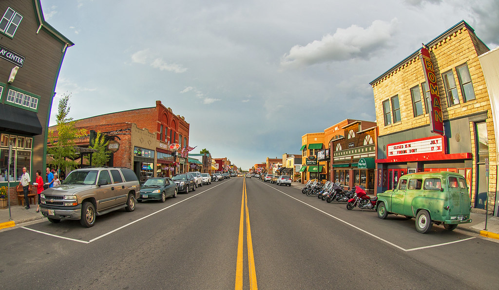
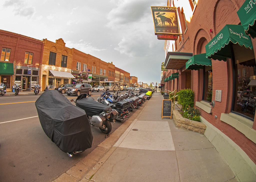
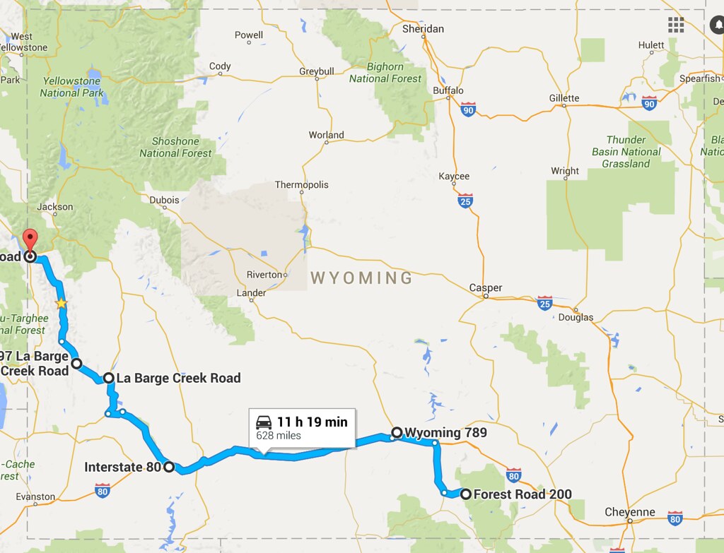
Ok, so I think I left off having made it up to Jackson. In short, Jackson is a cool town. I’d never seen so many obvious Vandwellers. (Flagstaff comes close, but there it’s more overland trucks and SUVs).  The bad part about Jackson: the super-tourists and super tourist shops at the town square.

I observed the vacation process of the female Asian tourist:
- Always, ALWAYS walk with phone in hand. Half of the time, phone pointed at face either taking selfies or participating on social media.
- Walk up to something (could anything that stands out: maybe the arches made of (fake?) elk horns at each corner of the town square, or maybe the war memorial in the middle of it)
- Look at that thing for 2.5 seconds. Don’t read any of the text.
- Take selfies for the next 280 seconds. After the perfect selfie, take a picture with various combinations of your travel partners. If you are in front of a statue, pose just like the statue.

This was not specific to asian women, but they seemed to be the most developed in this phone-centric vacation process.

I saw a guy who sealed the deal on the Jackson town square image: he was walking across the street recording what was probably a video using a phone on a selfie stick. Halfway across the street, he finishes the video, and tucks the selfie stick under his arm. He also has a DSLR hanging from his neck. Ok, maybe next he will use that to take a picture? Nope. Syke! He pulls a TABLET out of I can’t remember where, and holds it up in front of him to take a picture (probably of the elk horn arch he was approaching) This man has fully mastered the art of juggling multiple devices to produce the highest rate of Facebook and Snapchat spam.

The town square is not all bad. There are some cool shops there. I was impressed with the hats in those shops. I don’t know hat names - these are big round ones, but not full cowboy hats. They seemed like ok deals for how nice they appeared. I could use a hat like that, but I don’t know prices or how to judge quality, so I passed, assuming they are as overpriced as some of the other things in their store.

The next better thing about the town square is the free Wifi. There is Jackson city-provided Wifi there. It works better towards the south side of the square. This was important, because while I had a full signal, the Verizon cellular data speed in Jackson is worthless for anything other than text.

The best thing about the square was a conversation I had there. I was sitting on a bench reading a book, and an older gentleman sat down on the other end of the bench. He wasn’t doing anything, just sitting there and looking around. He had been there 20-30 minutes when I got to a stopping point in my book and struck up a conversation with him. He’s had an interesting life, at least as far as his career goes. He grew up in NYC and at age 15, right after his father died, he quit school and bought a dump truck and a chainsaw. He went out to Western NY and hustled himself a job doing tree maintenance work at a college or university. Then he went to school there. He went down a few career paths, leading to him being involved very early in the semiconductor industry, and eventually getting a big windfall from the sale of a startup company he co-founded. He’s traveled to a many different parts of the world and is a thoughtful and clear-speaking guy. He had very good advice, but it was nearly all about work. I tried to get some advice from him on long-term self-actualization, but the best I could get was advice on where to spend time this fall/winter given my outdoor activity interests (he said California).

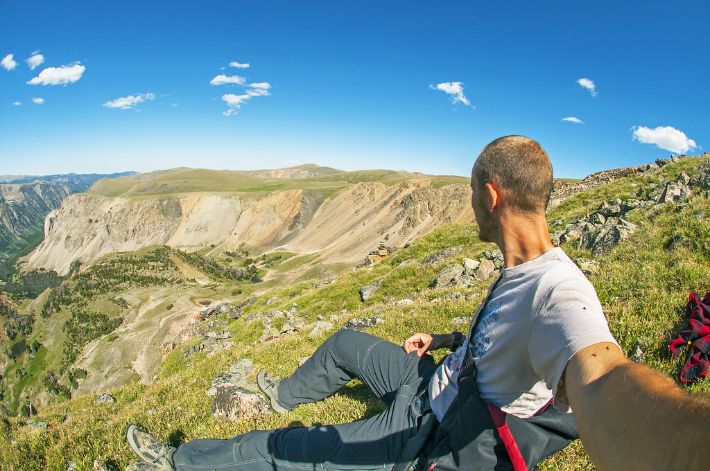
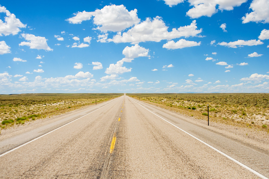
I spent about a day and a half in Jackson. I got maps and good advice at the visitor’s center, and bought a one-year National Parks pass. Next, I drove up into Grand Teton National park. I went to Jenny lake to go for a bike ride. There aren’t any good roads for road cycling in GTNP, but there is a 22 mile bike trail going from Jackson to Jenny lake. So I drove up to the lake and road to Jackson and back. I rode pretty hard and while I felt ok most of the ride, during the last 25% of it, I was fatigued. I could ride ok at an endurance or even tempo pace, but I had absolutely no top end punch. I didn’t really intend to ride so hard/long that I’d deplete my muscle glycogen like that. I used to ride a LOT, and was in WAY better shape a few years ago. It’s hard not to always compare myself to my best fitness

My neck, feet, and hands/wrists were quite fatigued by the end of the ride. It was too far/ too hard.. I need to ride less than that - about half as much at that exertion. That will be plenty to improve my fitness. And I need to work back up to all of my body being able to handle hard and long rides. There one silver lining in this is that I can get great workouts in without having to ride a bunch of hours now :-D  :-D

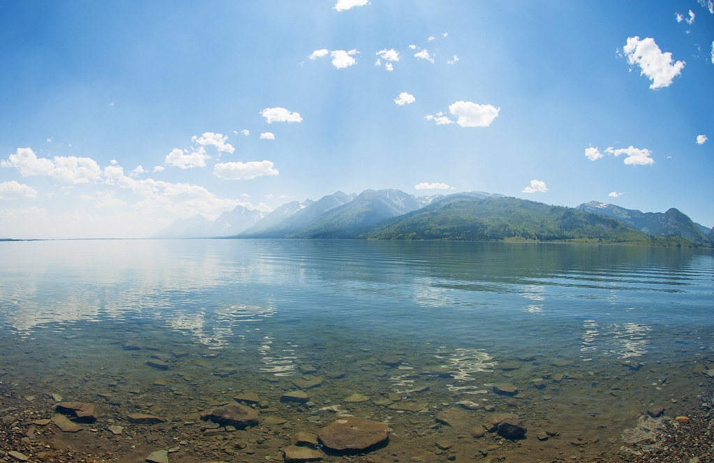
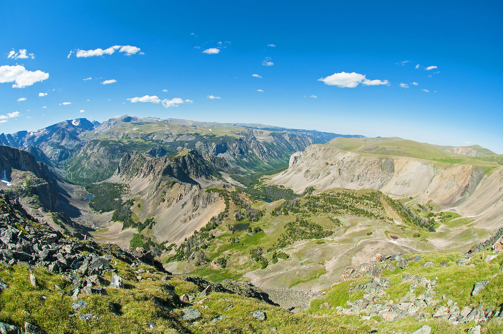
The Tetons are really cool mountains. As my brother described to me about a week before, the area is pretty flat, and all the sudden the mountains shoot up steeply. They are very different from the Colorado rockies. They were similar to the mountains I saw years ago in Banff. I had a good clear view of them while driving up and while bicycling south. But when cycling back north, I noticed a lot of smoke from one or two of the nearby forest fires rolling in. By the time I got back to Jenny lake, it was really smoky and hazy. Enough to spoil all the good views. I didn’t take any pictures in GTNP before the smoke, and then it wasn’t worth it.

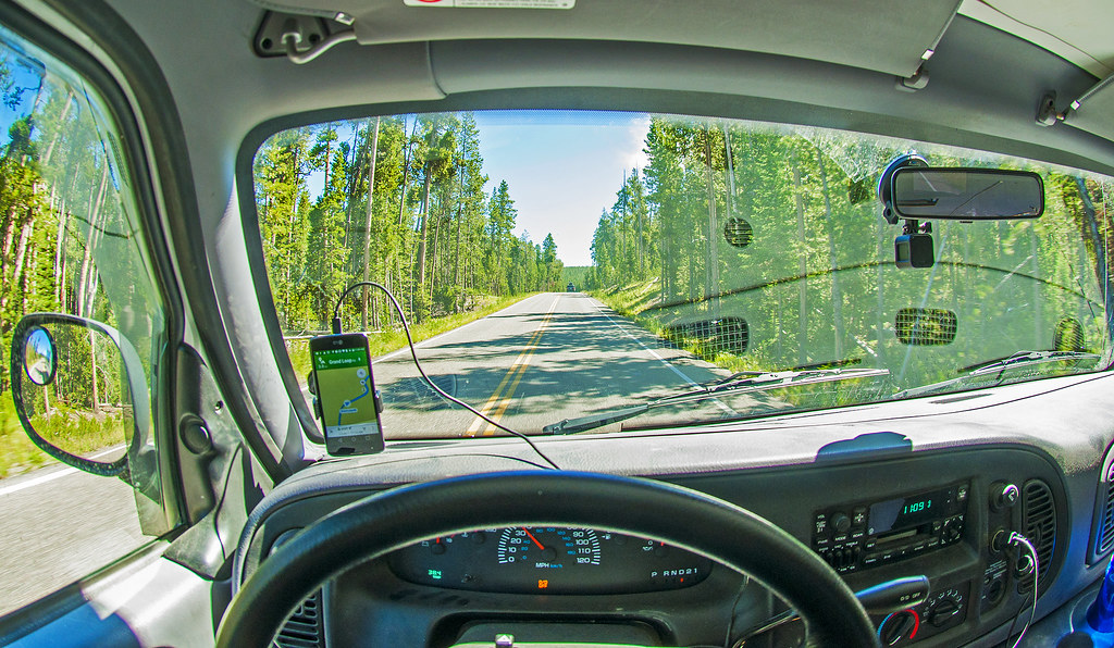
I was going to drive over to the National Forest east of GTNP to camp, but as I started driving that way, I could see it was smoky over there too. I decided to head up into Yellowstone and see if it was better there. So I drove north and the smoke gradually faded from view.

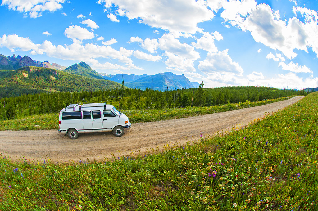
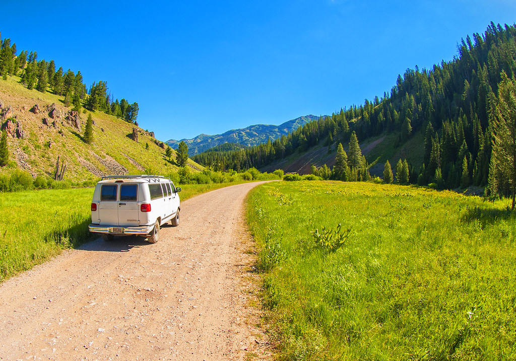
I didn’t take any pictures in Jackson. I need to start taking pictures in the towns also.

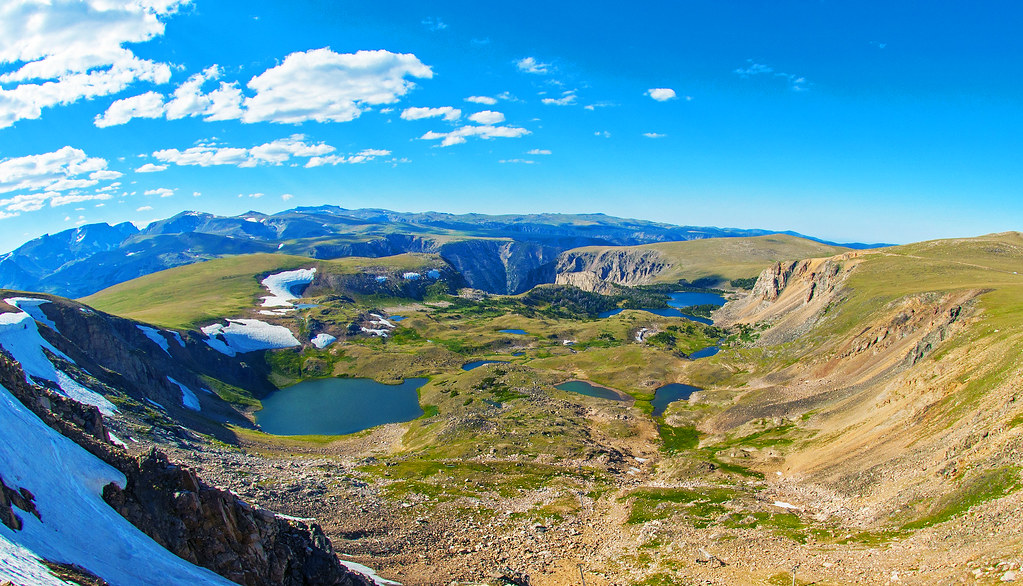
This was after I’d been driving north a bit, and it was less smoky than in the middle of GTNP, but still enough to spoil a view.

28471185471_8fb932a4aa_b.jpg


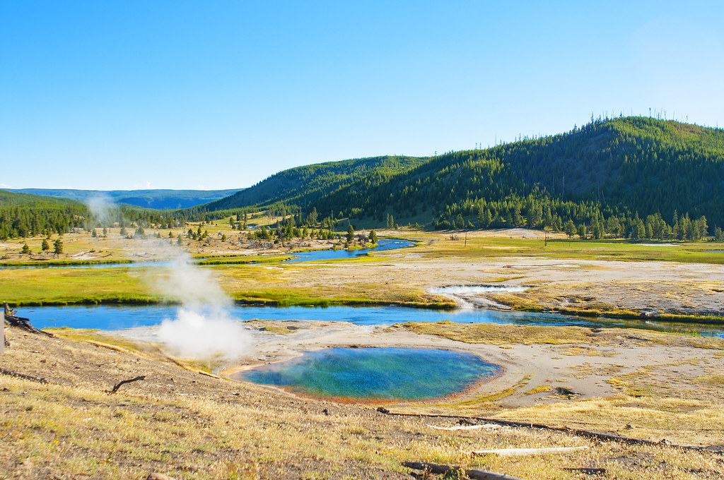
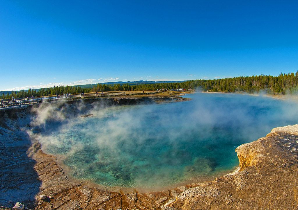
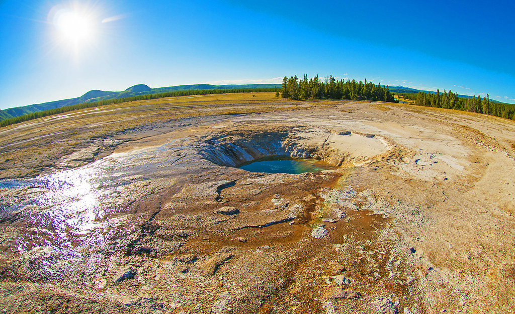
I stopped at some of the geysers/hot springs/whatever they’re called. I did stop at Old Faithful. I was really hungry and decided to eat before I walked over. It erupted while I was eating. It was too late in the evening to wait around for the next one, so I continued west.

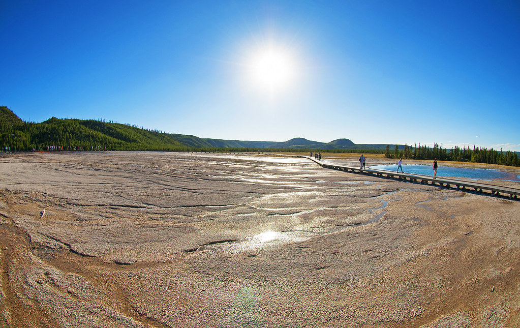
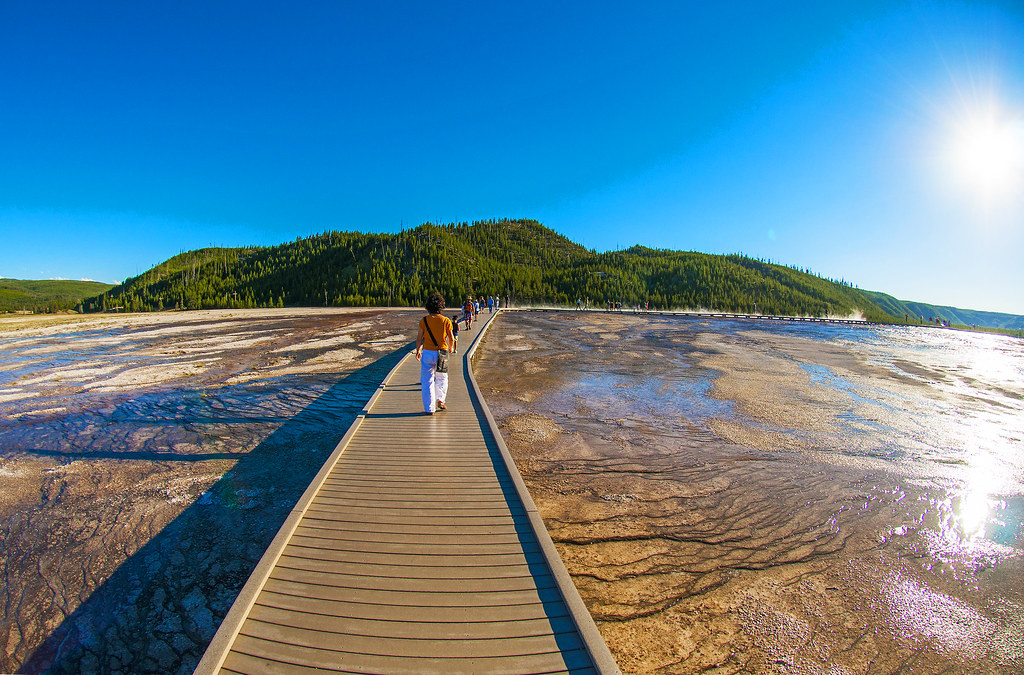
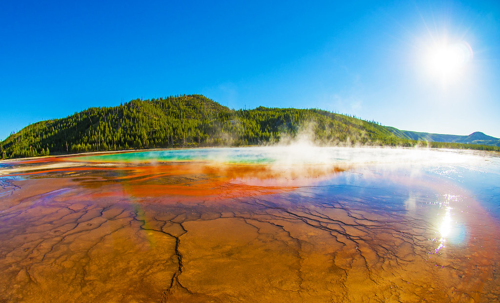
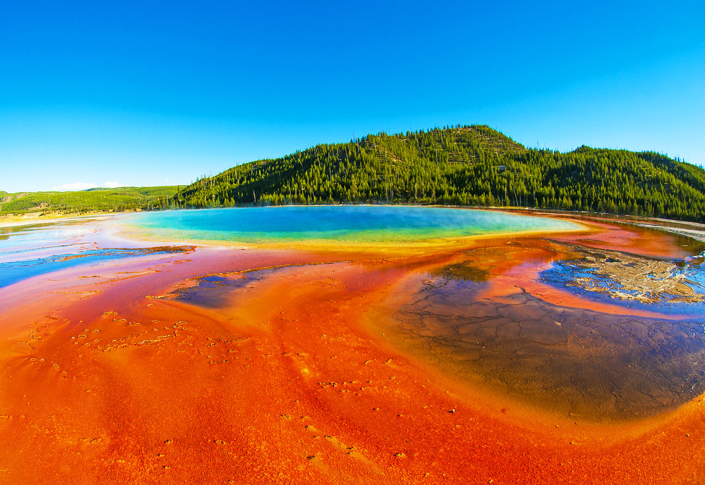
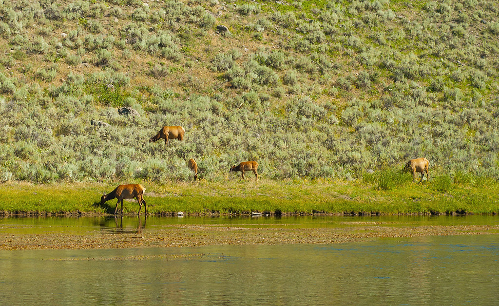
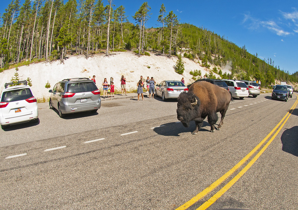
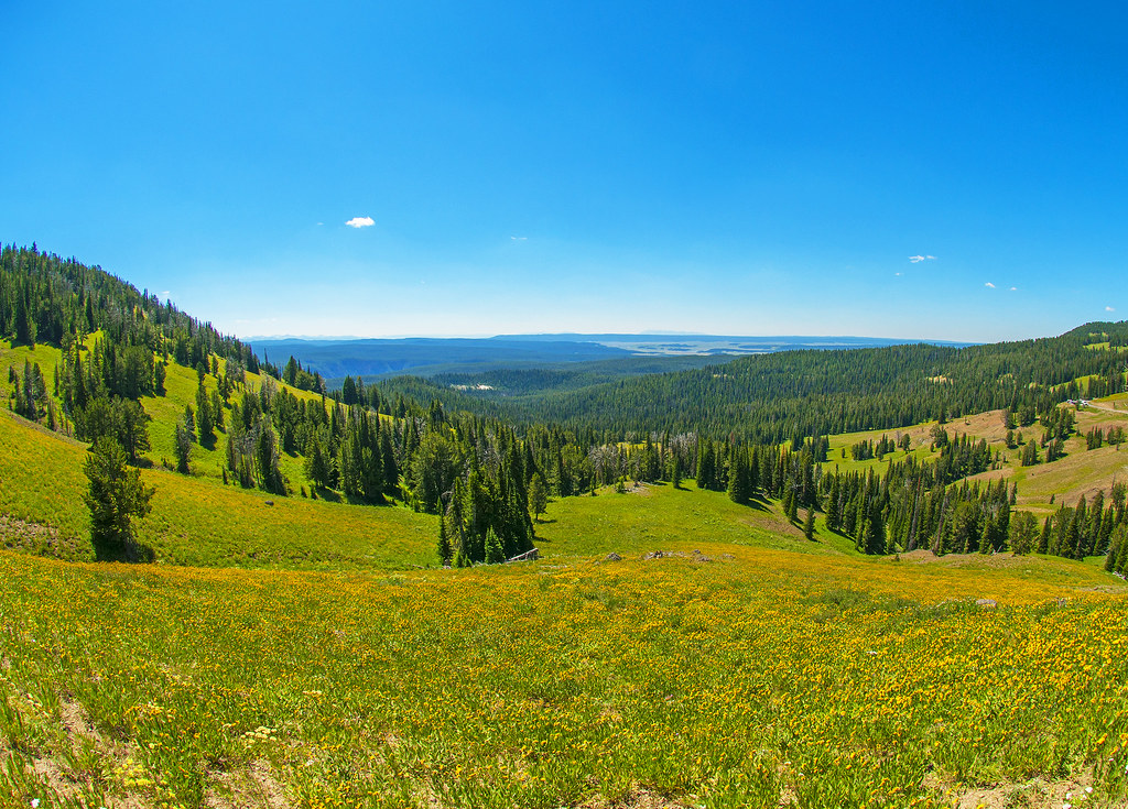
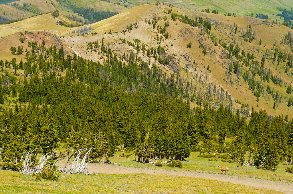
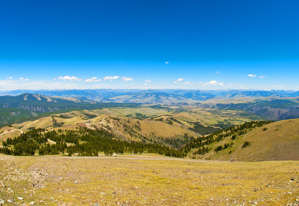
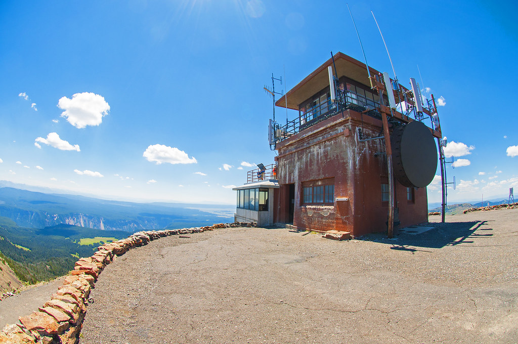
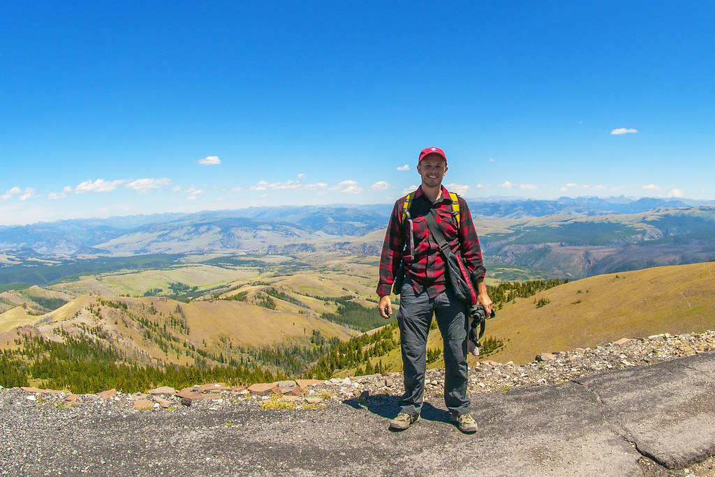
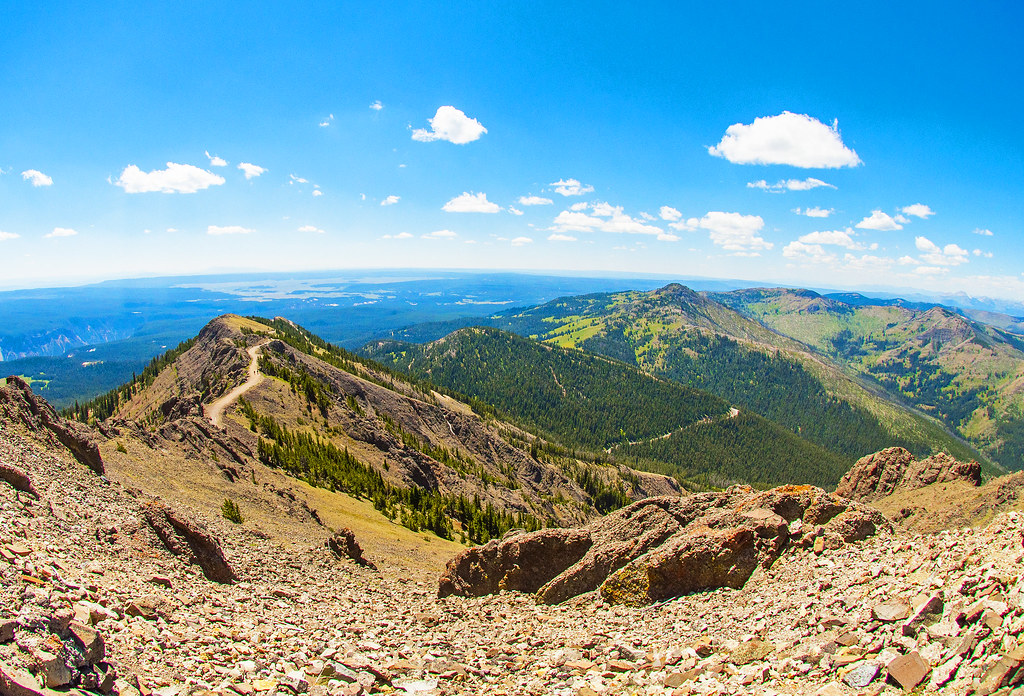
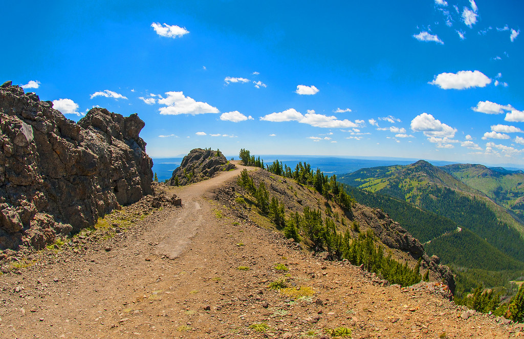
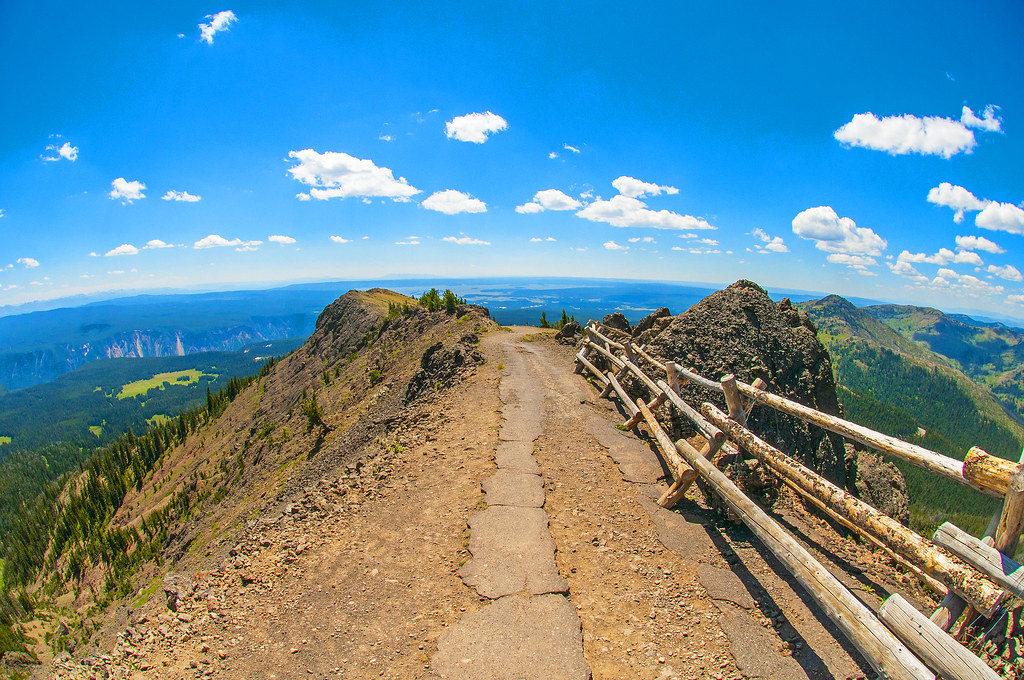
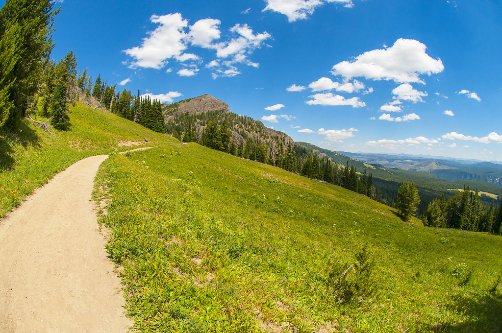
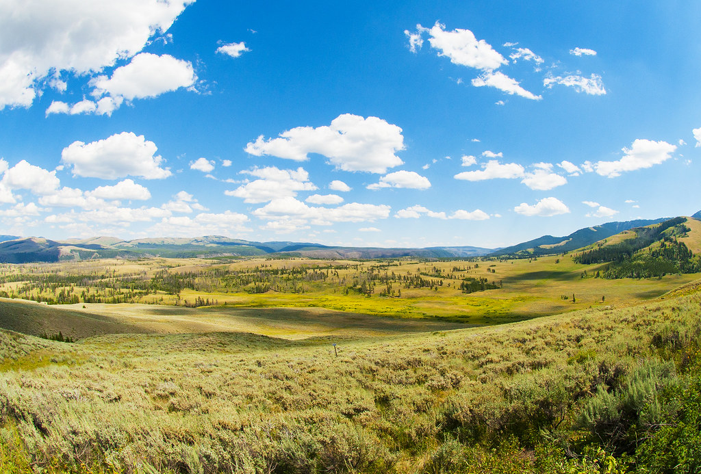
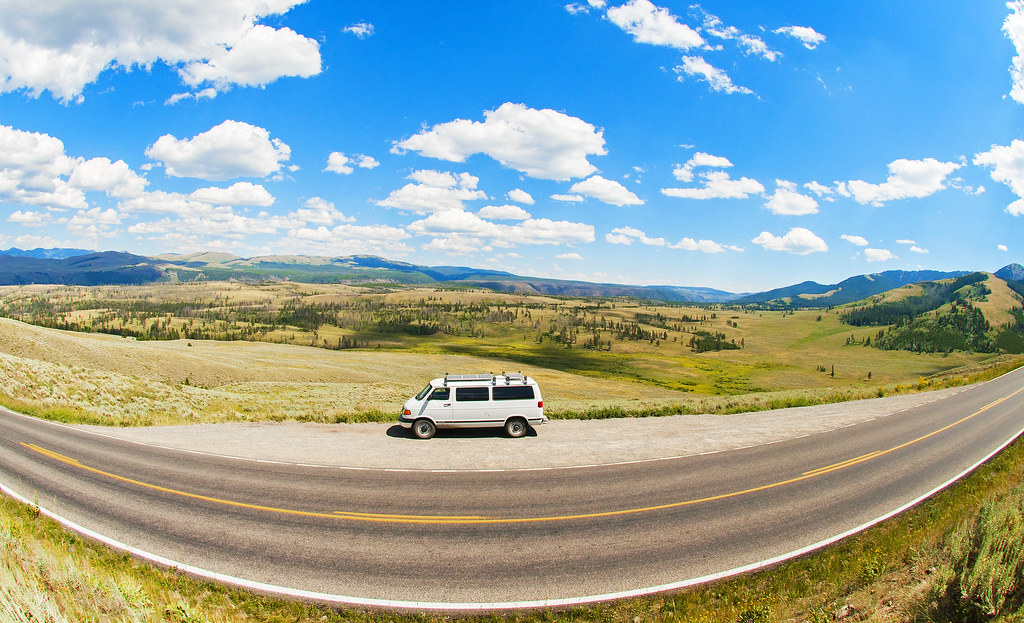
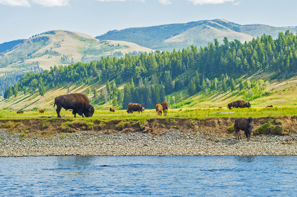
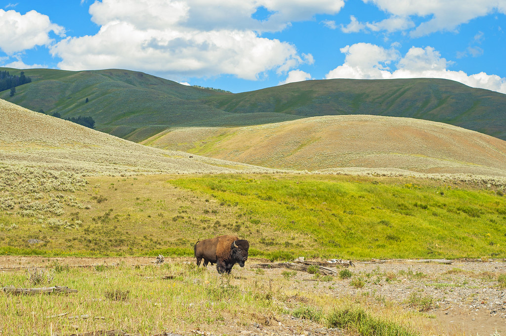
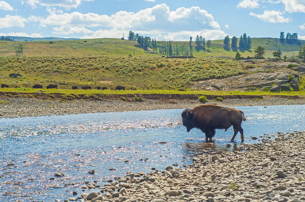
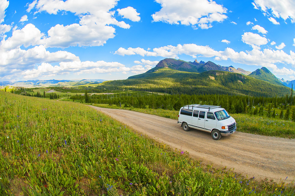
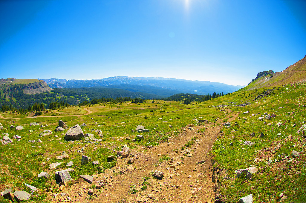
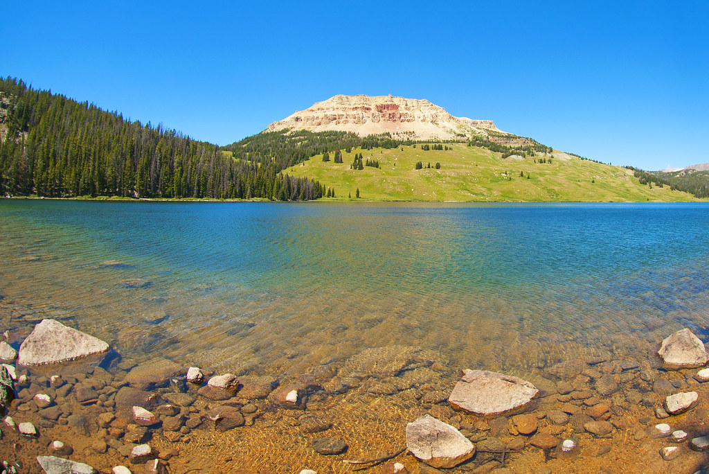
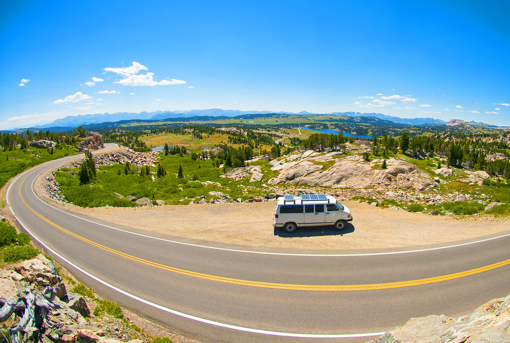
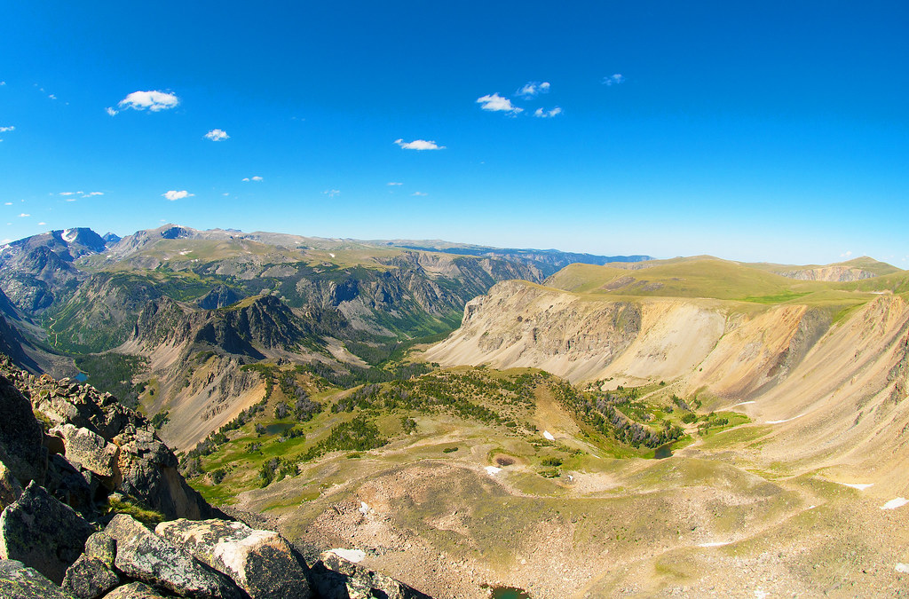
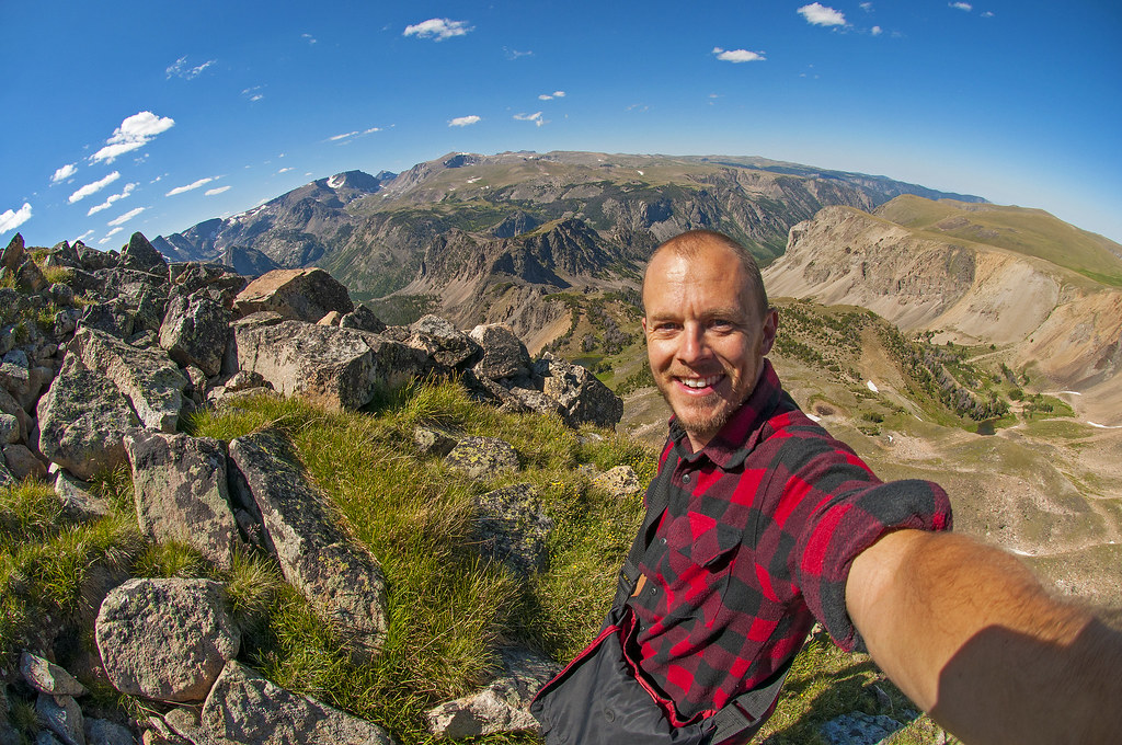
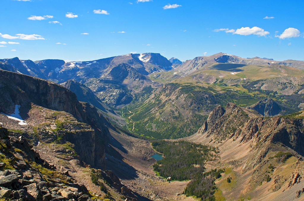
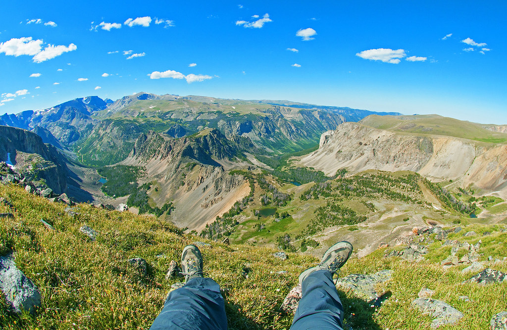
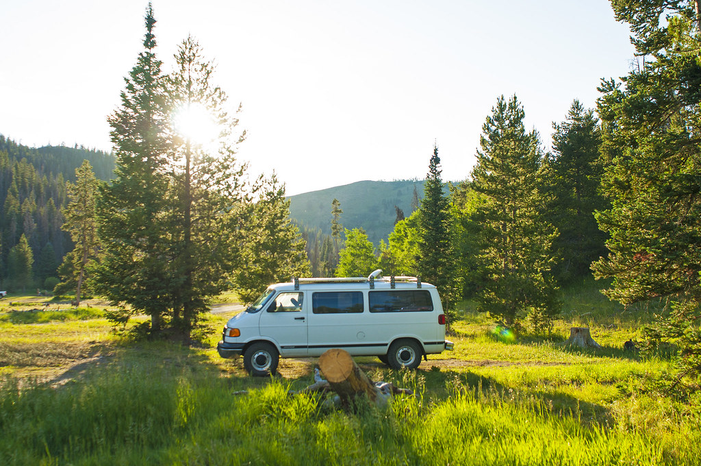
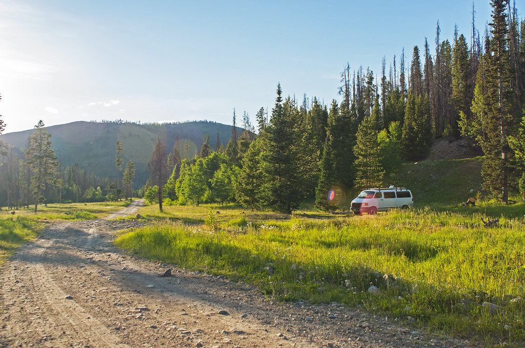
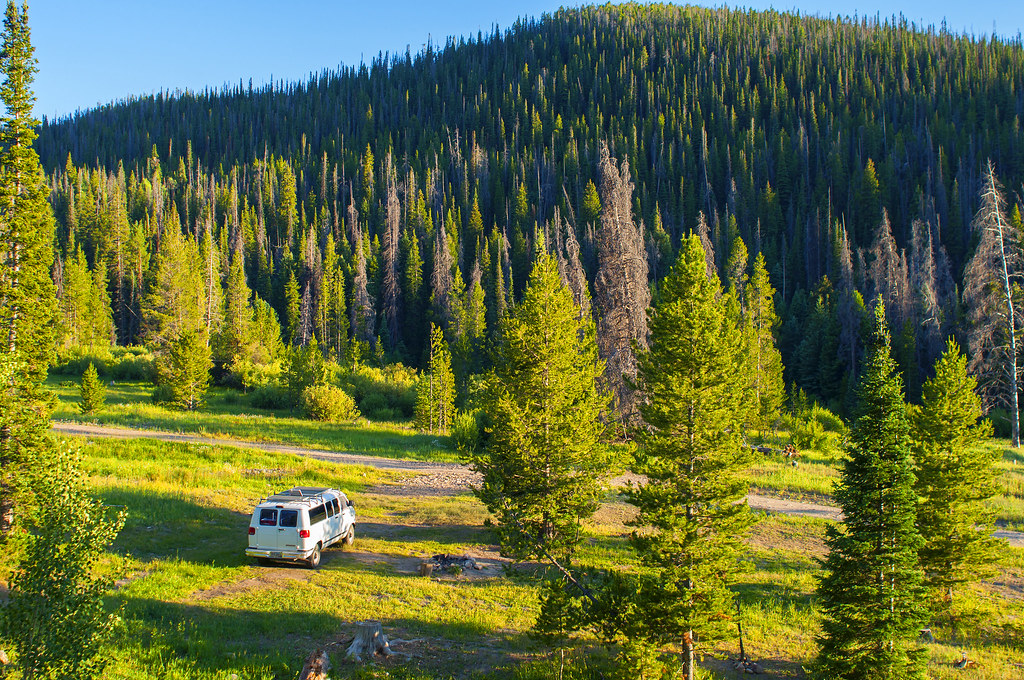
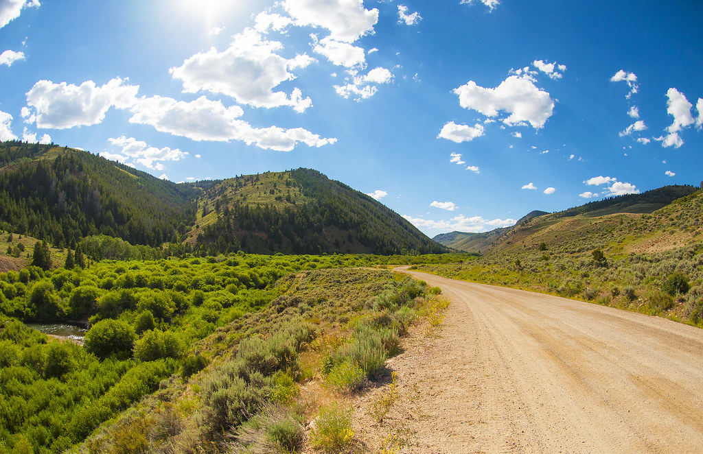
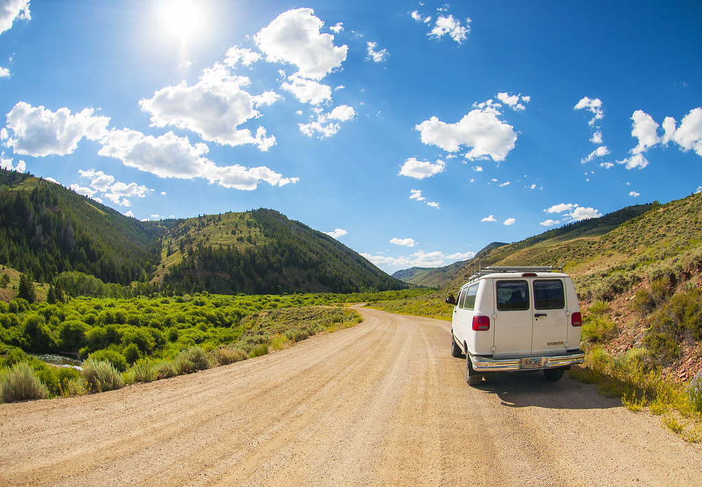
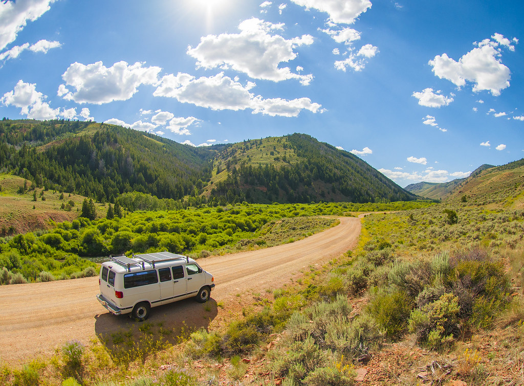
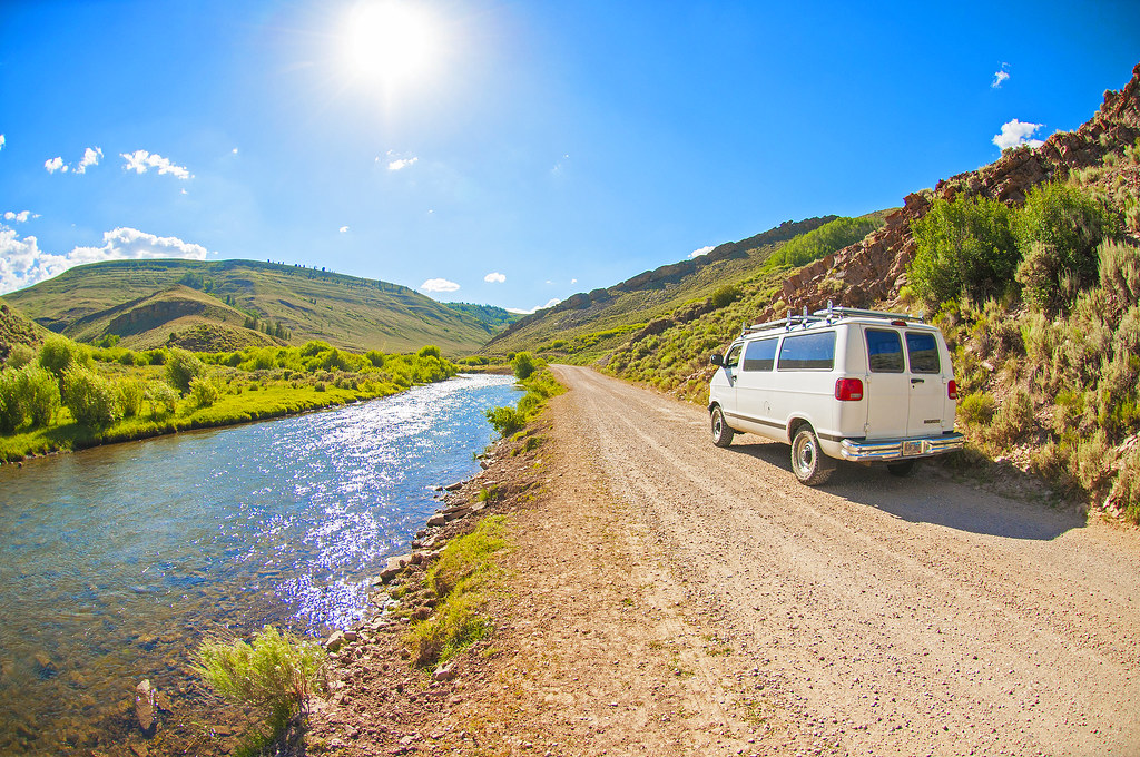
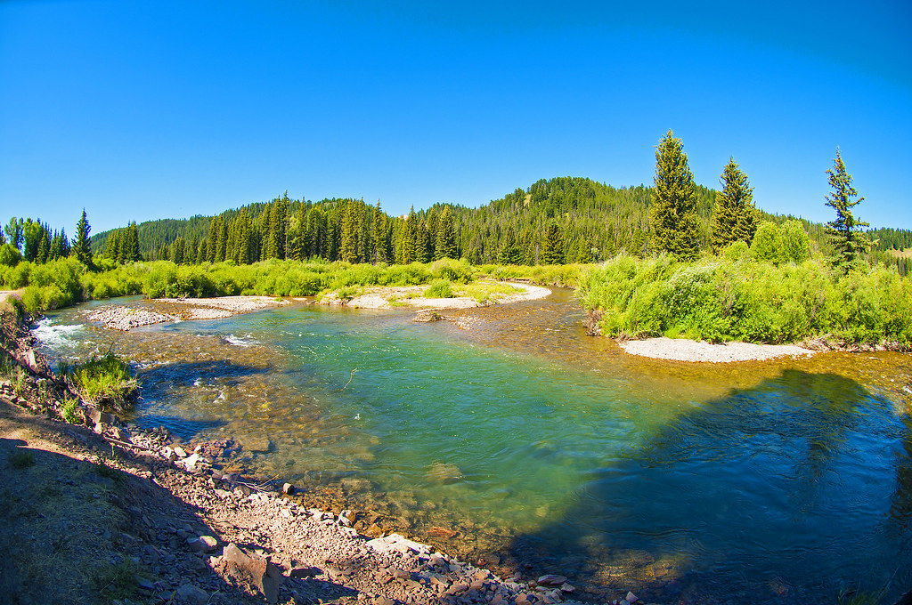
I’m just going to dump the pictures out. I’ll do some ruminating later on my overall impressions of Yellowstone and the surrounding areas.

28471163131_c358320458_b.jpg


27932052284_5127dfd31e_b.jpg


28549005415_f7a601d321_b.jpg


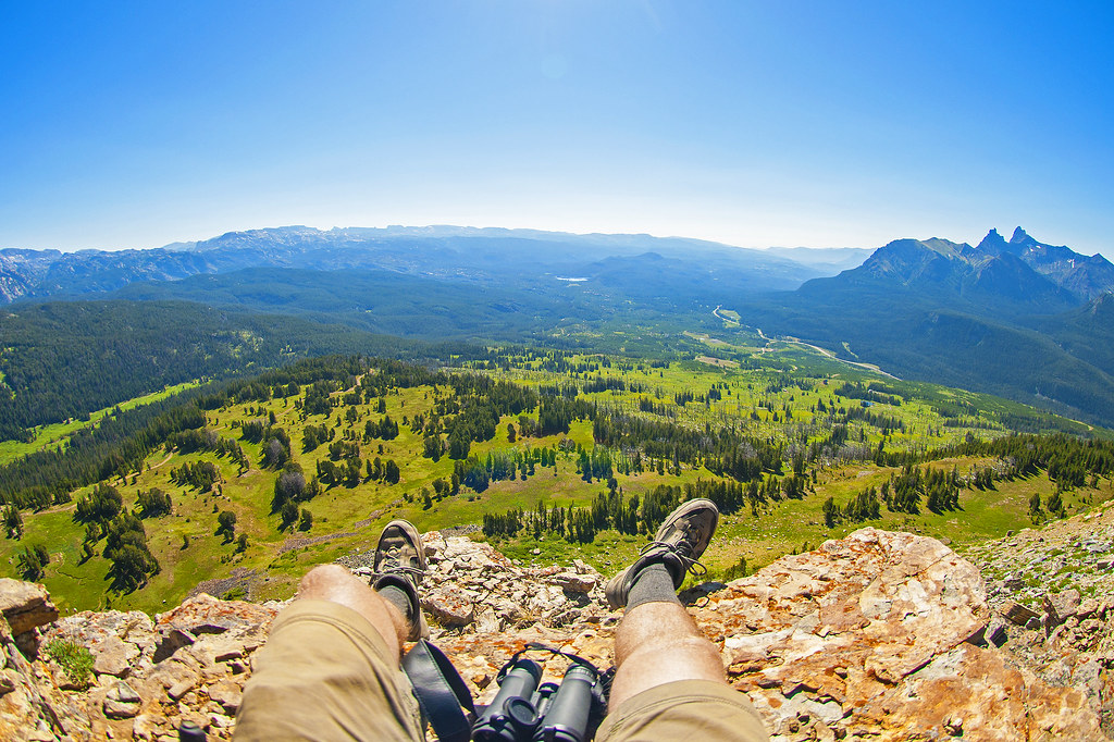
If you fall off, CERTAIN DEATH!
28264981690_c6a031c2bf_b.jpg


When I’d get gusts of wind blowing from this one towards me, I’d feel pockets of air 30+ degrees warmer than ambient. wow!
28548979125_3e90066ef2_b.jpg


28265043230_7905c9d66a_b.jpg


28442614982_d47fec4f7b_b.jpg


28548945735_04ee7d1aca_b.jpg


27931982594_7fb3cc6c90_b.jpg
 
… Continued…

27933393703_c31574519b_b.jpg

(That’s a “Overdrive off” light, not a check engine)

I drove out the western edge of Yellowstone, to the town named West Yellowstone. I like this town much better than Jackson. It’s also a complete tourist town, but it has a different feel. It feels older. Simpler. Less like it’s trying to be something it shouldn’t be. It felt like a town suited to it’s purpose - to house, feed, and supply people going in and out of Yellowstone. No fancy jewelry stores. No designer clothes stores. It does have a few too many T-shirt stores, but if that’s a town’s only issue they are doing very well. Also, even while there were a lot of obvious tourists, including asian women, almost NO ONE had their phone in their face. People here seemed more in the moment. More connected with their travel partners. After the Jackson town square, that was very refreshing.

I’ll be going back through West Yellowstone on my way out of the area, and I promise I’ll take pictures this time.

I felt like I had been doing too much and moving too fast, so I spent about 36 hours holed up in West Yellowstone. When I left, it was to drive back into Yellowstone, taking the following route:

27933976614_c85727f2a3_c.jpg


https://www.google.com/maps/dir/Wes...2!1d-111.1041092!2d44.6621493!1m0!1m0!1m0!3e0


I stopped to hike up Mt. Washburn
28471030311_2ee94fcdfc_b.jpg


Is that a goat? (It almost looks like it could be a deer or elk in the picture, but it is MUCH smaller than those - like half the size.)
28442562152_b9f20cd86d_b.jpg


28548849265_ba723a086a_b.jpg


I was wondering what kind of waves were shooting through my body from all the stuff mounted on this lookout building at the top of Mt. Washburn.
28516511936_6d2295f943_b.jpg


27933317783_16d62d2ee9_b.jpg


28516458796_c259fa62c2_b.jpg


27931817634_415a47b7f3_b.jpg


27931781834_657daf2520_b.jpg
 
…. continued..


28470871471_e8403729e4_b.jpg


Then I carried on driving towards and onto the Beartooth Scenic byway.
28470795331_1717a217a0_b.jpg


28516282576_8a5ac69e59_b.jpg


28442251302_6519f2a101_b.jpg


28548484175_b5669b4eb3_b.jpg


I was surprised by how many waterfalls are in Yellowstone. I saw probably 15 so far.
28442210062_3709fc8570_b.jpg


28442191592_5e4f05c92a_b.jpg


28470637761_f13217b481_b.jpg


27931500334_374dd3a537_b.jpg


I was wondering if these bison are living as wild, or if they are cared for or managed. Anyone know? They seemed as docile as fully domesticated animals. If these act the same as the bison did two hundred years ago, it’s clear how easily a group of people could hunt them to extinction. You could walk up to these bison and shoot them execution style any they might not take a step in any direction other than falling over.

28516122436_4589eea72f_b.jpg


Up next, camping at the northeast border of Yellowstone and driving the Beartooth pass! The views are about to get BIG!
 
Falcon,

Thanks for the tour - my friend is the seasonal ranger at Mt Washburn working as a fire lookout - he lives in the glass area.

Brent
 
They're quite wild just used to people a little too much.
Getting close can quickly become a very bad idea!
 

----------------------------------------------------------------------------------------------------------
CAMPING N.E. of YELLOWSTONE
Near Cooke City
----------------------------------------------------------------------------------------------------------


After driving through Yellowstone, I camped just outside the Northeast entrance - pretty close to Cooke City.

Driving up:
28529680592_00d92efea4_b.jpg


28603650286_673f6b4ab1_b.jpg


28603673196_a02cd48dd2_b.jpg


28019927393_c32be140e8_b.jpg


Here’s where I camped. Not a big fancy campsite, but I don’t need one. There wasn’t much traffic on this road, so it wasn’t so bad being right next to it.
28351509870_afcc88bd9c_b.jpg


There sure are a lot of flowers here!
28636150145_f325f97001_b.jpg


28529501902_34e5dc98db_b.jpg


28529461902_e1b3f4e910_b.jpg


I got up around 4:30am to walk up a hill near where I camped to set up the GoPro on a tripod to take a time lapse of the sunrise. I don’t know why I keep doing this around here - there’s never any clouds in this region in the morning so there’s not really any sunrise to capture.

Later that morning I went for a hike:
28636031585_820ff866f2_b.jpg


28529441332_257a228b71_b.jpg
 

----------------------------------------------------------------------------------------------------------
BEARTOOT SCENIC BYWAY
Cooke City to Red Lodge
----------------------------------------------------------------------------------------------------------


I drove the rest of the way from my campsite near Cooke City to Red Lodge. It’s only 64 miles, but I stopped so many times (and hiked around and took pictures) that it took me all day.

Thank you to those who told me to drive this road. It really is incredible. I haven’t said “holy ****” so many times in one day for a long time. And these were all good holy fucks. The drive from Cooke City to the pass is nice on it’s own. There are a lot of lakes pretty close to the pass.

I would pass a whole lot of lakes. Over the whole day, I probably saw more than 100 (many far off in the big views on top of the pass)
28529429262_4caf407e21_b.jpg


28019720733_8a55a62a0b_b.jpg


Once the pass starts, there are a lot of switchbacks and elevation gain. This isn’t a pass that goes over a low, easy route. It goes to seemingly the highest point in 50+ miles. The views are incredible. This is why I spent so much time stopped. Up at the top, I spent a couple hours walking around. There are views to be seen in all directions - it does take a bit of walking to get to them. I spent a lot of time walking around north of the road. There is a high point with big views, but there is a moderate hill down from there - that goes down a couple hundred feet before dropping nearly straight down. I hiked all along that lower edge. It took a lot of hiking because it goes in and out, it’s steep, and it’s almost entirely covered in big rocks.


28635970305_1ecf42c497_b.jpg


28019663013_80882a2931_b.jpg


28529326672_26eaa1e389_b.jpg


28529293812_b2e1427076_b.jpg


28529307902_9b86b013b2_b.jpg


28603338396_2684c3dd8a_b.jpg


28557124271_61b4a5a8d9_b.jpg


I’m fairly disappointed with the pictures I got there. They really don’t do it justice. Part is just that taking pictures of some of these views flattens out the view and you can’t see the distances properly. Part is, I think, I haven’t captured and processed them nearly as well as is possible. When I’m back next summer, I’ll probably be better.
 
Awesome pics. I'm heading to Wyoming and Montana next week and can't wait! What have been some of your favorite places to camp or things to see?
 
SUV_RVing said:
Awesome pics. I'm heading to Wyoming and Montana next week and can't wait! What have been some of your favorite places to camp or things to see?

I like Yellowstone much better than Grant Tetons, but much of that is because there was a lot of forest fire smoke in the Grand Tetons when I was there. The drives are incredible - you can almost pick a road and go down it and it will be great, but Beartooth Scenic Byway is a guaranteed "holy ****!" kind of drive. None of the individual places I've camped have been exceptionally good. But, it appears you can kind of pick a place and god, and it's going to be pretty damn good.

The mountain towns have a cool feel. I've spent a couple days each in Jackson, West Yellowstone, Red Lodge, and now Bozeman. They're all cool and each is different. A warning - if you use Verizon data, it was abysmally slow while I was in Jackson. It was ok in the other cities.
 

----------------------------------------------------------------------------------------------------------
RED LODGE
----------------------------------------------------------------------------------------------------------


I like Red Lodge and found it fairly similar to West Yellowstone, except that here there are many more regular residents. The Beartooth pass closes during winter, and I assume they get very few tourists and the town becomes just a normal rural small town.

28641461675_b7d560d6cf_b.jpg


There sure were a lot of old white dudes passing through on their motorcycles.

28641482715_6260acf56e_b.jpg


I spent one day researching and buying health insurance. I’ll have no gap between then my previous employer-provided coverage ends this month, and my new coverage starts August 1. My income for this year is too high to get any subsidy. The cheapest plan on the healthcare.gov exchange was $235/month. I bought one that is $277/month because it has better coverage out of network and after deductible is passed. There as only ONE plan with a nationwide network. It was a gold plan from Samford, whom I read has a practice of canceling the policies of people using mail forwarding addresses. I’m looking forward to January of next year when I will get a big subsidy - since my income will only be my investment returns (mostly dividends), the amount I convert from one type of IRA to the other, and maybe some income from a hobby or two. My health insurance cost should drop to below $100/month.

28534829982_8cf60ebc95_b.jpg


So… where next? The factors impacting route decisions are:
- To get to Seattle around August 10
- Need to pick up some mail in West Yellowstone
- Don’t spend a lot more on gas than I really need to (I’m already buying gas much more quickly than would - in order to get from Denver to the PNW pretty quickly)


oh, fancy seeing you here
28357085260_5e0a109de5_b.jpg
 
I must say your pics have excellent color saturation. what's your trick. highdesertranger
 
Thank you hdr. Basically, I open them in Photoshop and increase the saturation ;-D


More details:
- shoot only in RAW (this allows more post-processing without making the image noisy)
- Increase contrast
- Increase exposure and brightness to accomate for the increased contrast
- Sometimes, increase the "shadows" or dark areas and decrease the "highlights" - this makes a more even exposure
- Increase "clarity"
- Modify the color balance - usually making the colors cooler and they are often too warm out of camera, and sometimes I can use this to bring out certain colors that the camera doesn't pick up as well as they really look

I spend maybe 30-90 seconds working on each picture in photoshop.
 
You hit the Beartooth at prime time for wildflowers!! I lived in MT for about 10 years and most of my work was doing PR for the tourism industry. I've been EVERYwhere in that state and the Beartooth has remained my favorite drive to this day. The Chief Joseph drive that goes from Cooke City south to Cody WY is pretty darn great, too.

Red Lodge has a mining history and existed as a successful small town before the tourism boom, so you are right that it is an up and running little city even in winter. In winter, you can get to Cooke City only by going through Gardiner, MT, and that NE route... snow plows keep the road open most of the time as there are full-time residents in those little towns. Hardy folks, eh?

Every north-south valley in central to western MT is worth your time, so there is much more to explore. Plus Glacier (which is fantastic in the fall but the nights will be very cold). South and west of Glacier especially has larch (tamaracks) whose needles turn bright yellow.

Wow... you've got me so "homesick" for MT and now I'm just gushing with great memories. But you know what the greatest thing about your photos and videos? You are so obviously just delighted to be where you are... your happiness just requires the viewer to smile back.
 
Thanks for all the pics...really makes me want to get out there and see it all for myself!
 
Top