Van-Tramp adventures 2014 (part 2)

Van Living Forum

Help Support Van Living Forum:

This site may earn a commission from merchant affiliate links, including eBay, Amazon, and others.
Golden Gate Canyon State Park has been on my todo list for some years now, yet because of it’s proximity it all too often got pushed to the “next week” list, but this past weekend I can finally add this notch to my belt.

Honestly, for the life of me I can not figure out why this area is a State Park. It is not really any different then the rest of the Rockies other than a fee is required. Don’t get me wrong, it is…
http://cpw.state.co.us/placestogo/parks/GoldenGateCanyon said:
​​More than 12,000 acres of dense forest, rocky peaks, and aspen-rimmed meadows laced with miles of trails awaiting the hiker, horseback rider, mountain biker and winter sports enthusiast at Golden Gate Canyon State Park
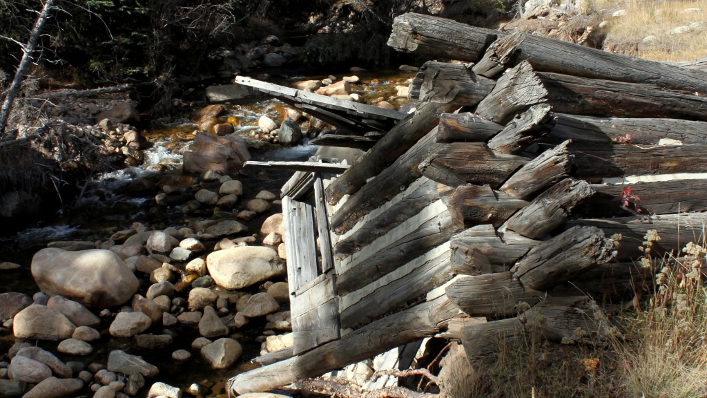
... but that can be said of a lot of the area around it too.

Nevertheless, Moose and I entered the park in the early morning searching for a little adventure. Our first stop was Panorama Point where I hear that you can see 100 miles of continuous mountain peaks from this one very spot.


Click for big-big image


We took the time to hike a small section of the Racoon Trail as well, only to find that we clearly got here too late. A month earlier and this forest would have shined with the yellows, oranges, and reds of autumn. No matter though, we auto-toured much of the park, stopping to each lunch, roam the tall dead grass, and even hiked a few kilometers as the mood struck us. I can’t complain about a relaxing day in the Colorado Rockies now can I?

More pics at http://www.van-tramp.com/wp/golden-gate-canyon-state-park/
 
North Fork Trail hike

Conor, Moose, and myself spent our Sunday hiking in the National Forest on the North Fork Trail. Conor and I have hiked here in the past, but the trail was mostly wiped out during the 2013 floods. Conor heard it had reopened so we set out to explore the meadow and dispersed camp sites a few miles out the trail.

Moose hiked the entire round trip off-leash (about 4 or 5 miles), returning every time I called out and never going out of sight. He loved it to say the least.

IMG_0455-1024x576.jpg


IMG_0482-1024x576.jpg


IMG_0485-1024x576.jpg


More pics at http://www.van-tramp.com/wp/north-fork-trail-hike/
 
Oh my, that picture of Moose standing up on his hind legs in the tall grass is just too precious!
 
Re-embracing my individuality
http://www.van-tramp.com/wp/re-embracing-my-individuality/

Civilization drives it’s victims into flocks, repressing the growth of individuality – John Muir

Just over seven months ago I returned to Colorado to be with Timmy for his birthday and a portion of his summer. Within days of returning, I found myself in a unique situation to complete some temp work to fluff the ol’ savings account a bit. I figured, “why not, I’m here anyway”. The work was suppose to last for 5 months – two months longer than my initially intended stay. As that time neared, I committed to another 3 months further extending my stay to the end of November. With the injury causing an abrupt end to the work, my commitments ended as quickly as I could tick off the checklist to get on the move again.

IMG_0498-1024x682.jpg


At 1pm on Thursday I became a tramp again. Civilization has had her grasp on me for so long I actually felt afraid for the first few hours. However, if you travel exactly 100 miles South & West from Longmont, Colorado following the Interstate, a person will cross the continental divide and everything is easy going – and quite literally – down hill from there.


By the end of the day I found myself well on the other side of the divide with a whole new adventure laid out ahead. I feel as if I am becoming an individual again, not just a cog in the corporate grind that is civilization.
 
Rifle Pond
http://www.van-tramp.com/wp/rifle-pond/

Rifle Pond is located near the Rest Area along Interstate 70 in Rifle, Colorado. The pond is a gravel pit that was created in the early 70’s when the interstate was being built. Before that time there was a large open area here where they held the annual Easter egg hunt and closer to the old river bridge was the location of the Calwell Honey Company. A trail forms a 1 mile loop around the pond – which Moose and I made sure to hike in the morning light.

IMG_0514-1024x576.jpg


IMG_0523-1024x529.jpg


IMG_0519-1024x575.jpg


IMG_0529-1024x576.jpg
 
I am glad you and moose are on your journey again. Stay safe. I love your posts and pictures:) Jan
 
Rifle Falls State Park
http://www.van-tramp.com/wp/rifle-falls-state-park/

Rifle Falls State Park’s lush vegetation and waterfalls have attracted photographers and movie crews from around the country who come to capture the area’s unique scenery… Rifle Falls State Park has 13 drive-in and seven walk-in campsites that sit to the south along East Rifle Creek. In 1998, the park underwent a facelift: new pavement, picnic tables, interpretive signs and increased handicapped access. “Roughing it” is a little easier with electricity at many campsites. Walk-in tent sites and sites with electric hookups are also available in the winter.
http://cpw.state.co.us/placestogo/Parks/RifleFalls

I must admit, the park is a little gem. At this time of the year, none of the campsites were in use, and I was one of only three cars in the park during my entire stay. A short hike (literally, only a few hundred yards) brought Moose and I to the falls where I paused to snap some photos while Moose sniffed around. After, we took the 1-mile trail that loops around and above the falls, and even has a few caves. Moose, once again, enjoyed an off-leash hike and responded so well to each of my calls, even when the squirrels made fun of his chicken-legs.

IMG_0539-701x1024.jpg


IMG_0547-682x1024.jpg


IMG_0540-682x1024.jpg


IMG_0542-1024x682.jpg

Moose and I stop for a picture in one of the caves.
 
Where’s Waldo-saurus
http://www.van-tramp.com/wp/wheres-waldo-saurus/

After a long morning at the Dog Park in Grand Junction, we drove the additional 24 miles to exit #2 on Interstate 70. Here, we planned to boondock a single night in Rabbit Valley in the McInnis Canyons National Conservation Area. As a bonus, the Trail Through Time is directly across the Interstate so to tire Moose out even more, we set out on the 1.6 mile hike.

I quickly came to realize that the exhibits were more fictional than real. Some of the signage stated it outright, “we found a bone here, but took it to a museum… but this is where it was” complete with a diagram to show exactly where the supposed bone was found. Other signs shows were the fossil still resides in the rock, but… you tell me. Can you find Waldo-sarus?

IMG_0552-1024x344.jpg


IMG_0563-1024x533.jpg


IMG_0565-1024x742.jpg


Answers to each at http://www.van-tramp.com/wp/wheres-waldo-saurus/
 
Dixie National Forest – Cabin Hollow
http://www.van-tramp.com/wp/dixie-national-forest-cabin-hollow/

After spending the past two days driving through Utah, Moose and I stopped in Dixie National Forest, a few miles outside of Bryce Canyon National Park. We were told of this boondocking spot by Aluminarium who used it earlier in the year. The site comes with full bars of Verizon 4G!

Google map @37.7329687,-112.2662921

When we first arrived we setup in a spot that I recognize from Leigh’s blog post, but after walking around a bit I found my heart wanting a different spot… so we moved. It was not easy, but Big Blue now has much more sunlight for the solar panels and Moose has a large flat area to play in. This spot is also more protected from the wind that came to visit today.

IMG_0595-1024x683.jpg

The move involved some shady dirt roads – I practiced my rut straddling.

IMG_0598-1024x682.jpg

The end result is more light and a larger , and flat, area

IMG_0600-1024x576.jpg

And what about the view?
 
What ABOUT that view! I'm cleaning out my home office, shouldn't even be here, but that gave me inspiration to keep working day and night. WEather permitting we'll be out of Colorado in a week or so.


Arriving at Lake Mead
http://www.van-tramp.com/wp/arriving-at-lake-mead/

Since leaving the Bryce Canyon area, where Moose and I boondocked a single night in the Dixie National Forest, things have been fairly uneventful. A 250 mile drive, spanning two days, resulted in us arriving at our destination of Lake Mead where we met up with a few other RVers to hang out for an undetermined amount of time.

IMG_0619-1024x400.jpg


We got our first south-west sunset of the trip last night, treated out to a airstream-cooked potato and root soup, then finished the night off by going into Las Vegas to see a movie (John Wick) with the guys. I had forgotten that this part of the country lives on Pacific time, so my 11pm Mountain Time return to the van was exhausting. Luckily, it was followed by a great night’s sleep in 50 degree overnight temps.

IMG_0628-1024x576.jpg


Our first task was to scout the area with Moose and find an easy way to get to the water so we can test Moose’s new life preserver later in the week. Even though it takes a bit more of a hike to get to the water then our previous visit, once again Big Blue’s size (or lack there of) allows me to get a little further “out there” then the big RVs. I could get within a few dozen yards of the water, but that just means I would have to hike up to the others to socialize every day.

IMG_0634-1024x432.jpg


This morning is the first time in a long while I removed my window coverings, let the air flow through Big Blue, and completed some work with a spectacular view over my desk space. Out one side of the van is Lake Mead, and the other side is a view of the Airsteam camp above us.

IMG_0645-1024x576.jpg


IMG_0640-1024x685.jpg
 
Great pics!! Looks like an awesome spot. Sure looks like Moose is enjoying it, haha.
 
Crossing in California
http://www.van-tramp.com/wp/crossing-into-california/

I was parked at the Scotty’s Castle Junction to Death Valley on Hwy 95 (about 30 miles North of Beatty) when I woke at 2 AM for no good reason. So I got to the driving and finally crossed into California via Hwy 266 from Nevada & Hwy 168 up and over the Westgard Pass in the Inyo National Forest in California. Moose and I actually stopped in the Ancient Bristlecone Forest for a nap before the sun rose which turned out to be a great thing. With morning rays in the sky and our descent from the mountain pass, we were welcomed into California by the Sierra’s themselves…

IMG_0678-1024x576.jpg


IMG_0679-1024x576.jpg


I then pulled into a scheduled stop at the Keough Hot Springs just South of Bishop for a morning bath and a selfie. I did try to convince Moose to come in, even forcing it on him once – he kept a good distance from me after that.

IMG_0682-1024x574.jpg
 
Volcanic Tablelands
http://www.van-tramp.com/wp/volcanic-tablelands/

The Volcanic Tablelands is a vast volcanic landscape that was formed over 700,000 years ago by materials spewing from the Long Valley caldera, located to the northwest [of Bishop, CA] – BLM

Moose and I sent a single night camped out on top of the Volcanic Tablelands and even though I have hung onto this post for a few days trying to find something to say about the area, it still escapes me. Basically, it is an adequate place to boondock right out of Bishop, CA with 3G & 4G signals depending on your line of sight to Bishop. Other than that, there is little else to talk about. The pictures probably say more than I can…

IMG_0712-1024x576.jpg


IMG_0703-1024x575.jpg


IMG_0690-1024x622.jpg


IMG_0718-1024x399.jpg
 
Top